

Following the trail along roads.
Following the trail across roads, over ski areas, and through towns was harder than hiking through the woods.
ROADS
We’d only been on the trail about twenty-four hours when we came to our first road crossing. We heard the road well before we stepped out of the woods at Route 9.
I’d been to this trailhead before, but I’d never noticed the noise because I’d arrived for a day hike by car. I was amazed that in just twenty-four hours I could forget not only what traffic sounds like but also dismayed to discover it stinks.
The next day, after fourteen miles of beautiful woods, we emerged onto a dirt road. We were hot; we were tired; our feet hurt, and we couldn’t find the trail. We reread the guidebook and looked again for a blaze. We found a faint one painted on a tree and walked toward it, looking for another and for the place where the trail reentered the woods.
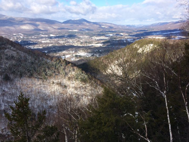
The view from Prospect Rock, New Year’s Day 2017.
Fatigue skews judgment, and it seemed as if we must have walked too far, so, we doubled back. My feet throbbed. We turned around again.
Two runners approached. Did they know where the trail headed north?
They sure did, and they recommended that we stop to admire the view at Prospect Rock.
It was spectacular. So was a brief rest. Revived, we shouldered our packs and walked another two miles to the night’s shelter.
SKI AREAS
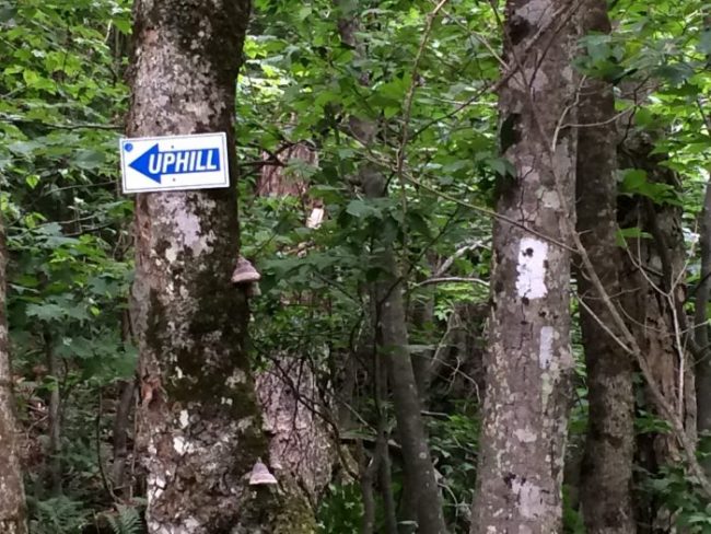
Unusually well marked trail at a ski area.
As we hiked north, the terrain became steeper and the road crossings fewer. Instead of roads, we crossed ski trails, where it was even harder to keep track of the trail. Neither the trail nor the blazes were obvious in the clearings populated by ski lifts and assorted outbuildings.
Eventually, we learned to find white blazes painted on ski lift foundations, on rocks embedded in the ground, and on snow fences. Between the challenge of following the trail and the exposure to the harsh sun in the clearings, it was always a relief to reenter the woods.
TOWNS
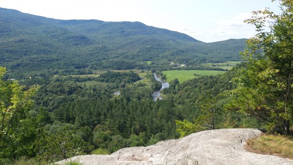
Overlooking the town where we lost the trail.
We also lost the trail just west of Johnson, the location of our last resupply. We left the woods on a trail that turned into a dirt road, then followed a paved one, and finally joined a rail trail, all according to the guidebook’s directions. We walked as instructed, on the lookout for white blazes. We didn’t see any, and knew we’d gone too far when we came to a river; we turned back.
A jogger saw us. It’s obvious we’re hikers; evidently, it’s also obvious we’re lost.
“Are you looking for the trail?”
“Yes!”
“It’s just down there.” She pointed to a short post with a double blaze that’s visible from this direction. “It crosses the field.”
“The field that’s just been mowed?”
“Yeah.” She smiles. “Makes it harder to see the path.”
No kidding.
We thanked her and walked past a cemetery, where a military funeral was in progress.
Before I hiked the Long Trail, I was always at ease in places of human habitation, places with street names, sign-posts, and buildings with numbers.
Before I hiked the Long Trail, I was always a little lost in the woods, and always relieved at the end of a hike to return to the car.
But since hiking the Long Trail, my view of the world has shifted. Now, I’m slightly distrustful of the human-made landscape and more at home in the woods.
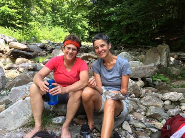
Lunch Break: Hiking the Long Trail meant Living Outdoors for 25 days.
I’ll be giving a talk about Lessons From the Long Trail, with slides, on Thursday, May 4 at The Learning Collaborative on Route 5 in Dummerston, Vermont, starting at 7 pm. Sponsored by the Dummerston Conservation Committee.
Hi Deb
Jeff and I will be heading back on the Long Trail before we know it…reading your post brings back memories of last summer.
It was great hearing you tell your story up in Brattleboro over the winter. Maybe we’ll see you on the trail again sometime…
Happy Trails
Judy and Jeff. ( your Tillotson Camp bunk mates) 😊
Hi Judy! Great to hear from you! Yes – I miss the trail. This year, I’m hoping to section hike with Tim (aka The Mule) who resupplied us last summer between keeping the garden weeded and his day-job. We might very well run in to you, as Tim has only a 70-mile section left to finish his end-to-end (over 30 years!). we’re planning on starting in the north and work our way back to Route 2. We’ll probably also hike in the Whites and get above tree line.
As you can probably tell: I miss the trail!
Regards to Jeff – and happy trails,
Deb.
I love reading your blog…it gives me great strength to carry on just walking around my area for exercise.
I also loved your book Into the Wilderness….do you have any more for me to read…
I am a city girl living in Vermont..from Philadelphia…i love it here..
You give me strength to overcome stuff that comes up…
Aylanah Laurie Katz
Aylanah, Thanks for these very kind words! It’s so good to know that at least on occasion, I fulfill my mission “to tell stories to create change”!
All best,
Deborah.
PS: I’m working on a few new books. Stay tuned!
I agree with Aylanah. Inspiring always. Getting so excited because next week I leave for my house in Chester and will be there on and off through the summer. Planning on attending your talk in Dummerston on May 4. Are you offering any writing classes, workshops, etc. over the next few months? If so, count me in.
Kathy Bonnez