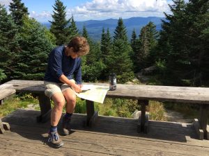
Mt. Mansfield Forces a Change of Plans
We’d planned to hike an ambitious ten miles on September first, but we stopped after arduous six. It wasn’t the distance that stopped us; it was the topography, forcing us to change our plans.
Our plan was to climb and traverse Mount Mansfield, descend to Smuggler’s Notch and ascend again to Sterling Pond Shelter. We didn’t make it.

Mansfield is Vermont’s tallest mountain with four distinct peaks: The Forehead (3,940), The Nose (4,062), The Chin (4,393) and Adams Apple (4,062). I’ve skied Nosedive and Chin Clip, both black diamond trails. Climbing is harder: there’s no snow to buffer a fall. Also: I’m afraid of heights.
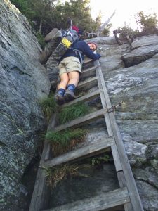
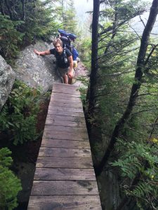
Despite warnings about how hard Mansfield could be, we disregarded the guidebook’s advice about the best route for backpackers and stuck to the Long Trail, knowing this entailed, “a steep and rough climb over rocks and ledges, using ladders in some places.”
Yup.
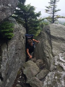
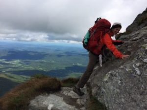
Climbing the Forehead involved bouldering, climbing ladders and taking off our packs to squeeze through a chimney and overhang, then hauling our packs up by rope. We were on the edge of the world, but in good spirits with good weather.
From the Forehead we traversed the summit, skirting the Nose, which is populated by communication towers, and arrived at the Visitors’ Center, which was surreal. After all that edgy climbing: cars, port-a-pots, tourists in flip-flops and sight-seers who’d come up on the lift.
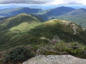
We continued across the ridge into a cool mist, right past the Profanity Trail, the supposedly easier route off the Chin. We were having none of it. Besides, the guidebook said, “The view from the Chin is dramatic.”
Yup.
The mist lifted; sunlight illuminated a blaze that fell off into space. I didn’t look at the view or think about the narrow ledge. I focused on the rock under my feet and hands, negotiating each toehold and handhold one at a time. Hikers waiting to ascend cheered me on; Jan followed.
We stopped at Taft Lodge to consider our options. Book time for the 3.6 miles we’d come so far was two and a half hours; it had taken us six. Book time for the 5.5 miles to Sterling Pond Shelter was three and a half hours. All I can say is: we were punchy having made it over Mansfield, the weather was good, and we were determined: we decided to stick to our original plan.
But by the time we descended into Smuggler’s Notch it was 4:30. While we had more than enough determination to keep going, we didn’t have enough daylight, and we were tired. We reconsidered our options. We even accounted for this one important fact: it’s in the fatigue of late afternoon that hikers make bad decisions. We stopped for a snack and a phone call to Tim, postponing our resupply by a day.
We knew we were risking not making it to Canada, so it was a hard decision to make. We hitched to Smuggler’s Notch State Park for the night, and hitched back to the trailhead by eight the next morning. Even refreshed, this trail was abusively steep, and we didn’t arrive at Sterling Pond Shelter until noon, only affirming that we’d made a good decision by changing our plans.
We also enjoyed an unintended consequence from our change of plans: a hot shower at the campground, proving that sometimes a change of plans can be a very good thing.
Go ahead: Subscribe to receive an essay every Wednesday. Just enter your address in the box, click subscribe and check your email to confirm you’re a reader and not a robot.
Deb, great pics and explanations of your adventures. 😉
So glad you’re enjoying the blogs! And so kind of you to let me know. xxD.